MAPMIND LAB
![]() Transforming Spaces with Geospatial Intelligence for a Smarter Tomorrow.
Transforming Spaces with Geospatial Intelligence for a Smarter Tomorrow. ![]()
Welcome to
MapMind Laboratory

At MapMind Laboratory, we firmly believe that maps are the intelligence that shapes a better world, not merely a collection of lines and colors. Our aspiration strives to use geospatial technologies to solve the most important socioeconomic, environmental, and developmental issues that arise every day. We are driven by purpose and creativity.
Every day, our team of passionate experts transforms raw spatial data into actionable insights that drive real-world change. Whether it’s building smarter cities, promoting environmental sustainability, supporting disaster risk reduction, or guiding infrastructure planning, we are committed to making spatial intelligence accessible and impactful for everyone.
We welcome you to join us - students, researchers, organizations, businesses, and governments alike - as we plot the present, plan the future, and prospect sustainable opportunities.
Together, let’s reimagine the way we see the world and turn information into transformation.
Ernest RUZINDANA
CEO & Founder, MapMind Laboratory
About MapMind Lab
Who we are:
geospatial intelligence laboratory
Our Core:
the core of MapMind Lab is Cartography
Boyond Mapping
creativity and innovation for
smarter & more resilient community
Geospatial Intelligence Laboratory
MapMind Lab is an innovative organization at the forefront of applying geospatial technologies to solve today’s most pressing societal challenges. Rooted in the art and science of mapping, MapMind Lab focuses on creating accurate, actionable spatial data that empowers diverse stakeholders - students, researchers, organizations, businesses, and governments - to make well-informed, impactful decisions.
The core of MapMind Lab
At its heart, MapMind Lab is about cartography - leveraging cutting edge geospatial tools to visualize, analyze and solve complex spatial issues. The Lab’s capabilities span geospatial analytics, ICT integration and design innovation to address challenges in urbanization, environmental management and sustainable development. Driven by this core, MapMind Lab aims to transform cities, particularly in the developing world, into smart and resilient urban ecosystems. Through strategic urban planning, innovative urban design, sustainable construction and urban resilience projects, the Lab works to build smart communities that are better equipped to face future challenges.
Beyond Mapping
MapMind Lab is more than just a geospatial organization; it is a laboratory of ideas and innovation where the latest advancements in geospatial intelligence, ICT, and design are combined to foster societal progress. The Lab also emphasizes capacity building, offering training programs that equip urban practitioners and fresh graduates with essential skills, empowering them to contribute meaningfully to sustainable development.
MapMind Lab isn’t just mapping spaces – it’s mapping future.
Our Impacts
- 100+
Trained
- 100+
Story Maps
- 50+
Blog Articles
- 50+
Publications
- 20+
Testimonials
MapMind Lab delivers innovative geospatial solutions to address societal
challenges and drive sustainable development. We specialize in advanced mapping,
urban planning, environmental management, and resilience projects. Through research, publications,
training, and collaborative initiatives, we empower professionals and organizations to create smarter,
sustainable communities aligned with the Sustainable Development Goals (SDGs).
- 1.Geospatial Analysis and Mapping
- 2.Smart Urban Planning and Design
- 3.Environmental Management Solutions
- 4.Capacity Building and Training
- 5.Research and Publications
- 6.Geospatial Data Solutions
- 7.Collaborative Development Projects
Key Impact Areas
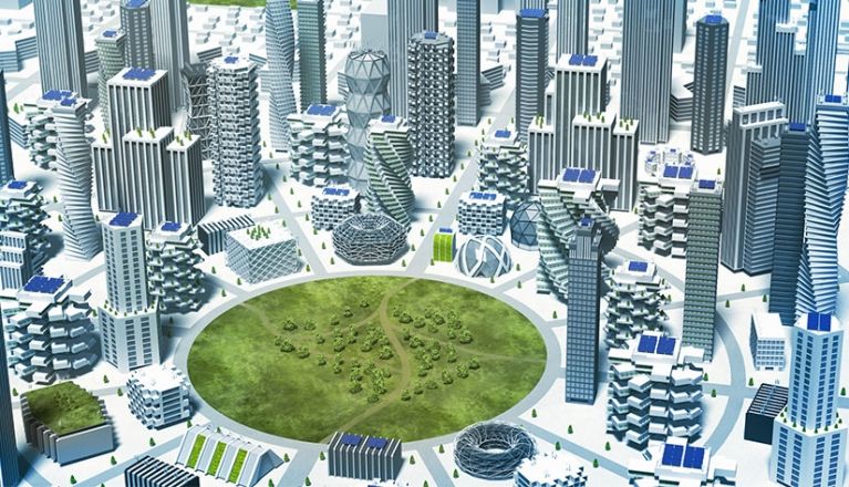
Smart Cities Development
| i. | Focus: Shaping technologically advanced and livable urban spaces. |
| ii. | Impact: Promoted smart city initiatives in urban areas, integrating geospatial intelligence for optimized land use, smart infrastructure, and improved public services. |
| iii. | Highlight: Developed GIS-driven models for sustainable transportation, mapped informal settlement areas in Kigali and beyond, and provided data for urban upgrading initiatives. |
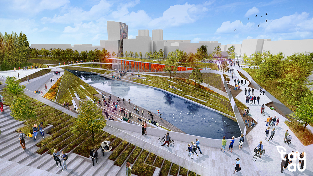
Urban Resilience
| i. | Focus: Building adaptive cities capable of withstanding climate, economic, and societal challenges. |
| ii. | Impact: Conducted risk assessments and identified over 50 high-risk zones prone to disasters, supporting the relocation of vulnerable communities. |
| iii. | Highlight: Mapped flood-prone areas in Kigali and surrounding regions, informing mitigation strategies and urban resilience planning for residents. |

Environmental Sustainability
| i. | Focus: Promoting resource conservation and ecological balance through geospatial analytics. |
| ii. | Impact: Mapped the critical ecosystems and supported conservation projects that enhance biodiversity and natural resource management. |
| iii. | Highlight: Developed climate adaptation tools and land use plans to address challenges like deforestation, water management, and urban sprawl. |
Education and Capacity Building
| i. | Focus: Empowering professionals and students with cutting-edge skills in geospatial technology, ICT, and design. |
| ii. | Impact: Trained 500+ individuals, including fresh graduates and urban practitioners, through workshops, capacity-building programs, and hands-on projects. |
| iii. | Highlight: Published 10+ research articles, created accessible datasets on disaster-prone and informal settlements, and enhanced global knowledge on urbanization and sustainability. |
Featured Projects
This section highlights the impactful initiatives undertaken to address global challenges through geospatial intelligence. It serves as a showcase of the Lab’s innovative work across various domains, including urban planning, environmental sustainability, and technological advancement.
Featured Publications
This section highlights key reports, research papers, articles or other significant documents published by the MapMind Lab. It typically showcases the latest or most impactful publications, making them easily accessible to visitors. It can include the publication's cover, title, publication type, publication year, publication place, link to the publication document and subject area, helping to promote knowledge sharing and thought leading in the organisation's area of expertise.
Latest News
This section highlights key reports, research papers, articles or other significant documents published by the MapMind Lab. It typically showcases the latest or most impactful publications, making them easily accessible to visitors. It can include the publication's cover, title, publication type, publication year, publication place, link to the publication document and subject area, helping to promote knowledge sharing and thought leading in the organisation's area of expertise.
Featured Story Maps
This section presents projects and adventures through an interactive, spatial lens. It combines maps with text, images and multimedia to showcase the journey, impact, and outcomes of various initiatives in a visually engaging way. This section allows users to explore projects geographically, illustrating where and how activities took place, and providing a dynamic storytelling experience that brings spatial data to life.
Testimonials
Get In Touch
This section provides everyone with an easy way to contact us. It may also feature links to social media platforms, encouraging further engagement. Its purpose is to facilitate communication, whether for inquiries, collaborations, feedback, or support.
If you prefer to reach us easily, you can visit us at the address below. You’ll also find our location, phone number, and specified working days and hours for your convenience.
- info@mapmindlab.com
- +250 783 486 141 / +250 783 486 141
- KN 2 Ave, Kigali - Rwanda
- Monday - Friday
- 08H00 - 5H00
Our Partners
This section highlights the organizations, institutions, and stakeholders that collaborate with or support our activities. It typically showcases partner logos, and sometimes links to their websites.