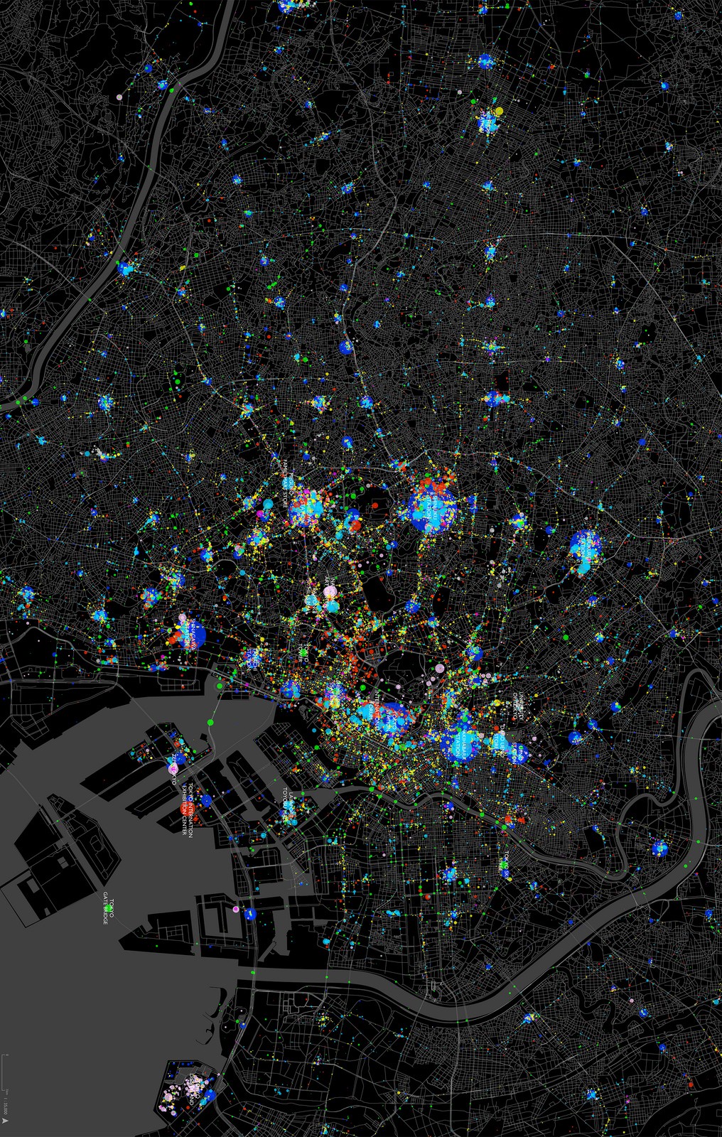
The Training & Capacity Building page reflects MapMind Lab's mission to empower students, professionals, and practitioners with advanced skills in geospatial technology, urban planning, ICT, and design. Through thoughtfully designed programs, it bridges the gap between theoretical knowledge and practical application, enabling participants to address challenges in urbanization, environmental planning, and sustainable development. By fostering a skilled and knowledgeable workforce, these services prepare individuals and institutions to drive transformative urban and environmental initiatives. Central to MapMind Lab’s commitment to advancing sustainable development, this offering ensures participants are equipped with the tools and expertise to make meaningful contributions to a better future.
Urbanization & Land Use Planning
The "Urbanization & Land Use Planning" training at MapMind Lab is designed to provide participants with in-depth knowledge and practical skills to address the complexities of urban growth and land use management through geospatial intelligence. This program targets urban planners, policymakers, researchers, students, and professionals involved in sustainable urban development. Participants are equipped with advanced tools and methodologies to analyze, design, and implement effective land use strategies that align with sustainable development goals.
Elaboration of District Land Use Plans (DLUPs)
Elaboration of Physical Plans Based on Land Readjustment Guidelines
Elaboration of Sectoral Master Plans
Land Use Plans Zoning Regulations
Spatial SWOT Analysis
Elaboration of District Land Use Plans (DLUPs)
The Elaboration of District Land Use Plans training at MapMind Lab is designed to provide participants with comprehensive skills to develop district-level spatial frameworks that promote sustainable urban growth, balanced land use allocation and environmental conservation. Utilizing advanced geospatial tools, trainees will learn to analyze land use patterns, allocate resources effectively, and integrate infrastructure needs with zoning and regulatory frameworks. This course emphasizes stakeholder engagement, policy alignment, and actionable planning strategies, ensuring participants can address real-world challenges. Upon completion, participants will be equipped to design and implement district land use plans, conduct spatial analysis, and guide decision-making for sustainable development. Targeted at urban planners, local government officials, and environmental practitioners, this training includes hands-on projects and case studies to reinforce learning. Graduates will receive accomplishment certificates, validating their expertise and enabling them to contribute meaningfully to urban planning initiatives, land use management, and sustainable district development projects.
Elaboration of Physical Plans Based on Land Readjustment Guidelines
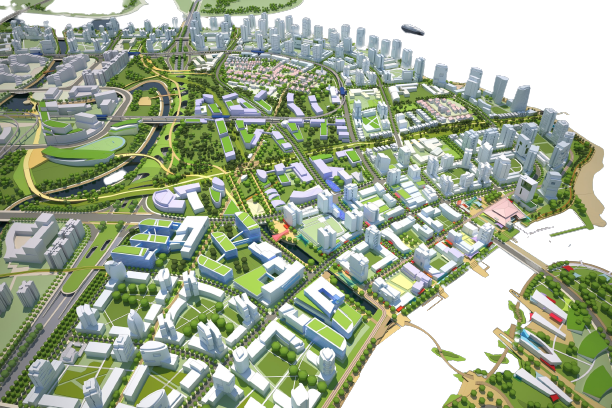
The Elaboration of Physical Plans Based on Land Readjustment Guidelines training at MapMind Lab equips participants with the expertise to design physical plans that transform fragmented plots into well-structured, serviced plots through participatory and systematic land readjustment techniques. This course emphasizes merging and reshaping irregular plots into standardized sizes and shapes while ensuring each plot is serviced with essential infrastructure, including roads, utilities, and public amenities. Special attention is given to designing a well-connected road network within the site to enhance accessibility and functionality. Participants will engage in practical exercises, case studies, and expert-led workshops to develop skills in creating zoning regulations, land use maps, and infrastructure plans that align with urban development goals. Graduates will receive accomplishment certificates, showcasing their ability to produce high-quality physical plans. After completing this training, participants will be prepared to implement land readjustment projects, optimize urban infrastructure, and drive sustainable urban development initiatives.
Elaboration of Sectoral Master Plans
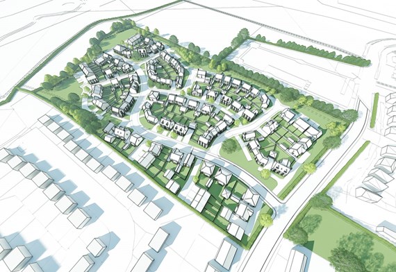
The Elaboration of Sectoral Master Plans training at MapMind Lab focuses on equipping participants with the knowledge and skills to create thematic spatial strategies for sectors such as housing, transportation, commerce, and more. This course emphasizes the integration of catalytic projects that align with the country's vision, driving sustainable development and economic growth. Participants will learn to design plans that incorporate sector-specific needs while ensuring alignment with other sectors to promote a balanced and interconnected economy. Through hands-on training, participants will develop zoning strategies, project prioritization techniques, and methodologies for integrating national goals into sectoral frameworks. Practical case studies will provide real-world experience in addressing sector-specific challenges. Graduates of the program will receive accomplishment certificates, demonstrating their ability to develop comprehensive and visionary sectoral master plans. After completion, participants will be able to implement plans that drive sectoral growth, foster collaboration across sectors, and contribute to the nation’s sustainable development agenda.
Land Use Plans Zoning Regulations
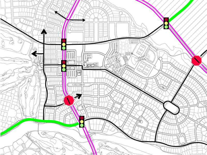
The Land Use Plans Zoning Regulations training at MapMind Lab is designed to equip participants with a thorough understanding of zoning frameworks and regulatory tools to manage land use sustainably and efficiently. This course covers the principles of zoning regulations, and implementing strategies to balance urban development, effective use of land resources, and social equity. Participants will explore best practices for managing competing land uses while fostering sustainable growth. Through a combination of theoretical lessons and practical exercises, trainees will learn to design zoning maps, draft land use policies, and establish frameworks that promote orderly development and compliance with local regulations. Real-world case studies and scenario-based exercises will ensure participants can address contemporary land use challenges. Graduates will receive certificates of accomplishment, signifying their expertise in developing and applying land use plans and zoning frameworks. They will be equipped to create plans and regulations that guide urban growth, optimize resource allocation, and ensure sustainable land use practicess
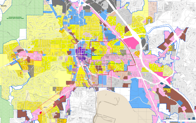
Spatial SWOT Analysis
The Spatial SWOT Analysis training at MapMind Lab focuses on equipping participants with the knowledge and skills to perform a systematic analysis of spatial environments, a critical step in master plan development. This training delves into identifying Strengths, Weaknesses, Opportunities, and Threats (SWOT) within a specific geographic context to provide actionable insights that guide planning and decision-making processes. Participants will learn how to analyze spatial data using geospatial technologies, assess land suitability, identify potential growth areas, and detect environmental and socio-economic vulnerabilities. The course also incorporates practical sessions where trainees work on real-world scenarios, applying SWOT methodologies to support balanced and informed master plan development. Graduates will receive certificates of accomplishment, signifying their capability to conduct spatial SWOT analyses effectively. Upon completion, they will be prepared to contribute to the development of master plans that align with sustainable development goals, ensuring well-informed, context-sensitive planning and land use management strategies.
Additional modules include Spatial Planning and Environmental Impact Assessment, Geospatial Data Integration for Land Use Policy Development, and GIS-Based Scenario Modeling for Urban Growth. Participants gain hands-on experience through case studies, GIS tools, and practical exercises. To enroll, individuals are encouraged to check the MapMind Lab website for detailed curriculum information, training schedules, and application deadlines, ensuring alignment with their professional objectives.
GIS & Remote Sensing
MapMind Lab offers comprehensive training in GIS and Remote Sensing, targeting students, graduates, professionals, researchers, organizations, and institutions. This program focuses on the application of advanced geospatial technologies to address contemporary and future challenges across various sectors, including urban planning, agriculture, environmental management, disaster risk reduction, and more. Participants will gain hands-on experience in spatial data collection, analysis, and visualization, leveraging cutting-edge tools and techniques to solve real-world problems effectively. The training emphasizes practical application, enabling participants to harness GIS and Remote Sensing technologies for decision-making, resource management, and sustainable development initiatives. By integrating the latest advancements, the course prepares learners to contribute to solving critical global challenges while ensuring a better future for the next generation. Successful trainees will receive certificates of accomplishment, affirming their expertise in using GIS and Remote Sensing tools. This recognition enhances their credentials, empowering them to excel in geospatial and multidisciplinary fields.
Application of Machine Learning in Geospatial Technology
MapMind Lab offers comprehensive training in GIS and Remote Sensing, targeting students, graduates, professionals, researchers, organizations, and institutions. This program focuses on the application of advanced geospatial technologies to address contemporary and future challenges across various sectors, including urban planning, agriculture, environmental management, disaster risk reduction, and more. Participants will gain hands-on experience in spatial data collection, analysis, and visualization, leveraging cutting-edge tools and techniques to solve real-world problems effectively. The training emphasizes practical application, enabling participants to harness GIS and Remote Sensing technologies for decision-making, resource management, and sustainable development initiatives. By integrating the latest advancements, the course prepares learners to contribute to solving critical global challenges while ensuring a better future for the next generation. Successful trainees will receive certificates of accomplishment, affirming their expertise in using GIS and Remote Sensing tools. This recognition enhances their credentials, empowering them to excel in geospatial and multidisciplinary fields.
