MapMind Lab's Story Map is a dynamic, interactive visual representation designed to publish and share moments, events and experiences in a spatial way using a navigation map. It allows users to document adventures or significant activities by simply taking photos, adding descriptions and uploading them directly to the map. Beyond personal storytelling, Story Map serves a larger purpose - creating societal impact by highlighting real-world challenges and opportunities. Through visual storytelling, Story Map helps raise awareness, foster community engagement, and provide insight into environmental and social issues, making geospatial data meaningful and accessible to all.

Smart Green Settlements Rwanda: Climate-Resilient Rural Transformation for Inclusive Growth
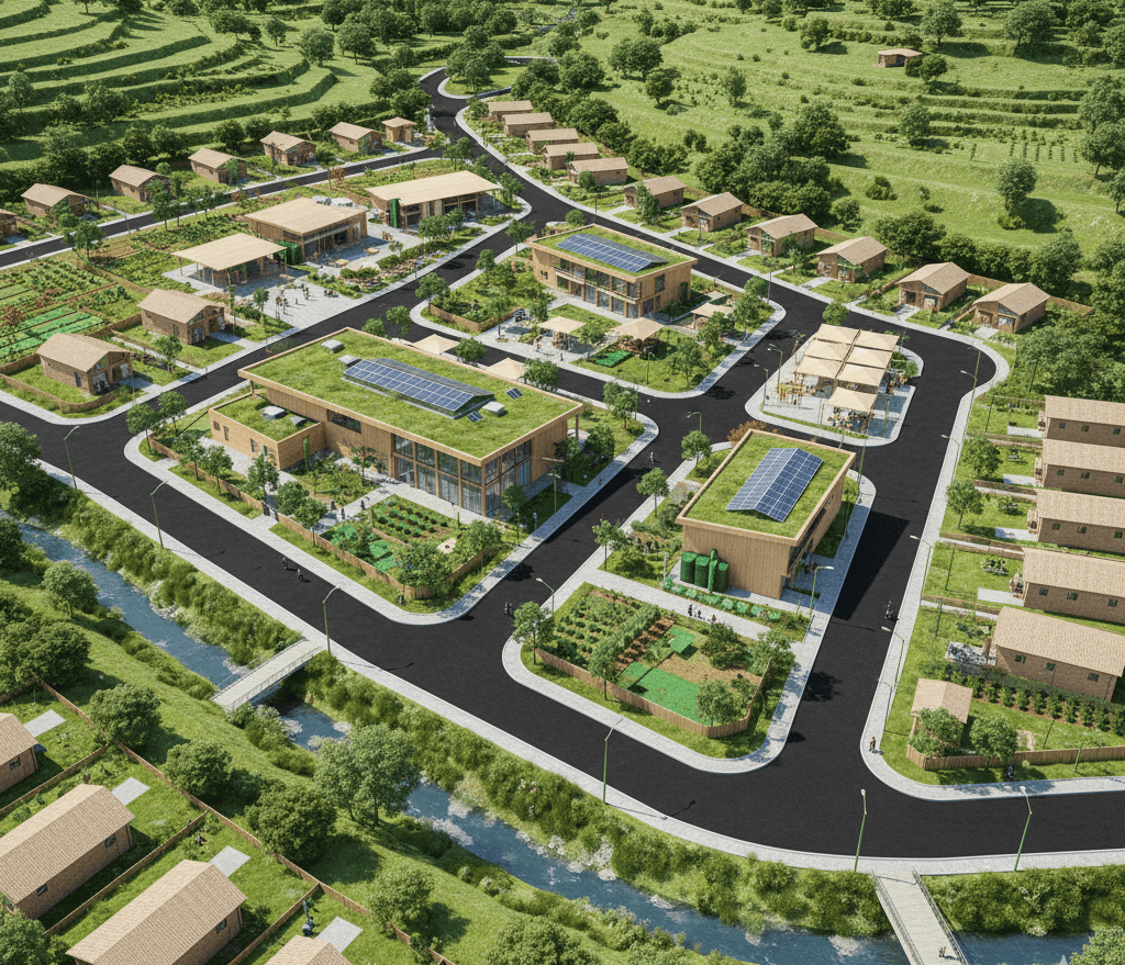
Rwanda faces growing challenges of informal settlements, disaster vulnerability due to topography, and unplanned rural housing patterns that undermine sustainable development. The Smart Green Settlements Rwanda project proposes an innovative, climate-resilient approach to rural settlement planning by establishing model green settlements in six pilot districts: Bugesera, Ngoma, Gatsibo, Nyagatare, Muhanga, and Ruhango. These pilots will form the foundation for future nationwide scaling.
The project will focus on planned rural settlement sites designed with integrated green layouts that prioritize climate adaptation and environmental sustainability. Core activities include tracing and constructing access and service roads, integrating essential infrastructure such as water supply, electricity, and internet connectivity, and designing residential parcels tailored for vulnerable communities. Affordable, climate-resilient housing units will be built to reduce risks from floods, landslides, and other climate hazards.
Beyond housing, the project will incorporate public amenities and social infrastructure, such as multipurpose community centers, healthcare facilities, schools, playgrounds, and waste management systems including landfills. Greening will be central to the settlements: tree planting, green corridors, and open spaces will enhance biodiversity, carbon sequestration, and community well-being, while also improving air quality and resilience against heat stress.
This initiative directly contributes to Rwanda’s Vision 2050, the National Strategy for Transformation (NST2), and the Green Growth and Climate Resilience Strategy by promoting orderly rural development, inclusive growth, and climate adaptation.
Through strategic collaboration with the Rwanda Green Fund (FONERWA) and the Ministry of Environment, this project will serve as a replicable model for harmonized rural settlement planning across Rwanda, driving a paradigm shift toward sustainable, climate-resilient, and inclusive rural communities.
- Project Duration:3 years
- Project Timeline:From June 2027 to December 2030
- Deliverables:The project will deliver high-quality geospatial datasets of housing, roads, and infrastructure, a comprehensive analytical report with recommendations, a geospatial database, and community engagement outputs.
- Source of Funds:Donors
- Key Partners:FONERWA, NLA, RHA, MININFRA, Districts, Green Climate Fund
- Key Stakeholders:Local Communities, Districts, FONERWA, Green Climate Fund, Government of Rwanda
- Project Status:UPCOMING

Geospatial Mapping for Inclusive Upgrading of Informal Settlements in Kigali
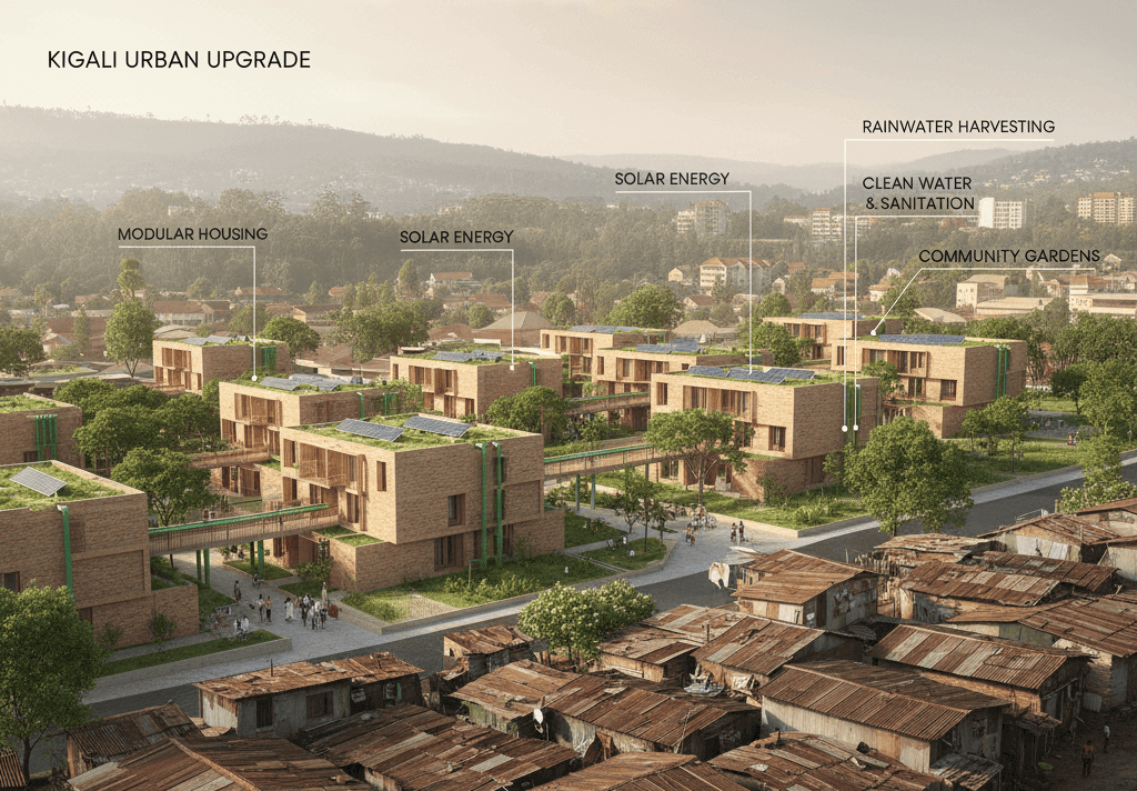
This upcoming project, scheduled to run from January to September 2026 under the MapMind Laboratory, focuses on the geospatial mapping of informal settlements in the City of Kigali to support evidence-based urban planning and infrastructure development. The initiative will employ advanced geospatial technologies to generate highly detailed datasets, including shapefiles of housing units, roads, paths, essential infrastructure, and physical features across targeted settlement areas. These datasets will form a reliable spatial foundation for city authorities and development partners to plan, prioritize, and implement upgrading initiatives.
The project is guided by the objective of leveraging geospatial intelligence as a catalyst for inclusive and resilient urban transformation in Kigali’s informal settlements. By producing actionable spatial insights, it will strengthen the capacity of decision-makers to improve service delivery, guide targeted infrastructure investments, and align upgrading processes with Kigali’s broader vision for sustainable and inclusive growth. A strong emphasis will be placed on participatory approaches, ensuring that community voices and local knowledge are incorporated into the mapping and planning processes.
Funded by the City of Kigali and implemented in collaboration with the National Land Authority (NLA) and Rwanda Housing Authority (RHA), the project will also engage local communities as central stakeholders. The key deliverables will include high-quality housing and infrastructure shapefiles, a geospatial database of physical features, and a comprehensive analytical report offering policy-oriented recommendations. Beyond data, the project will deliver a platform for dialogue between authorities, partners, and residents, helping to ensure that urban upgrading initiatives are both equitable and responsive to community needs.
The outputs of this initiative will serve as a cornerstone for sustainable and inclusive urban development in Kigali, enabling authorities to design targeted interventions, streamline service delivery, and foster equitable access to infrastructure. Ultimately, this project underscores the importance of using geospatial innovation as a practical tool to transform informal settlements into resilient, well-serviced, and inclusive urban communities.
- Project Duration:1 year
- Project Timeline:From December 2025 to September 2026
- Deliverables:High-quality geospatial datasets (housing, roads, paths, infrastructure, and physical features of informal settlements). Comprehensive analytical report with policy recommendations and planning guidelines.
- Source of Funds:Self Sponsorship
- Key Partners:CoK, NLA, RHA, MININFRA
- Key Stakeholders:CoK
- Project Status:UPCOMING